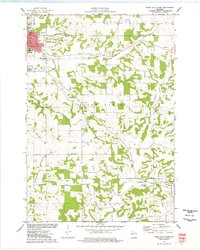
1974 Map of River Falls East
USGS Topo · Published 1977About this map
River Falls serves as the academic and cultural anchor for this mid-1970s landscape, dominated by the campus of the University of Wisconsin-River Falls and its associated Experimental Farm. The terrain is deeply etched by the Kinnickinnic and Trimbelle River systems, which create a dendritic pattern of wooded coulees and agricultural uplands. Evidence of former transit networks appears in the southeast, where an Old Railroad Grade runs parallel to Goose Creek toward the settlement of Beldenville. This survey is particularly rich for genealogical research, documenting several distinct burial grounds including Union Cem, Greenwood Cem, and the more remote Thurston Hill Cem. Scattered rural landmarks such as the Cherma Ch and various quarries suggest a long-established community structure that balances its collegiate character with a traditional agrarian and river-valley economy.
Find a feature on this map
36 named features on this map. Tap any name to fly to it.
Don’t see what you’re looking for? This feature index may not catch every label — zoom into the map to look around manually.
Map Details
Editions of this 1974 River Falls East Map
This is the sole edition of this map. No revisions or reprints were ever made.
Other maps of this area

1940 · Maiden Rock
USGS Topo · 1:62,500

1944 · Red Wing
USGS Topo · 1:62,500

1946 · River Falls
USGS Topo · 1:62,500

1949 · River Falls
USGS Topo · 1:62,500

1949 · Baldwin
USGS Topo · 1:62,500

1950 · Maiden Rock
USGS Topo · 1:62,500

1952 · Red Wing
USGS Topo · 1:62,500

1953 · Saint Paul
USGS Topo · 1:250,000

1959 · Saint Paul
USGS Topo · 1:250,000
1974 · River Falls West
USGS Topo · 1:24,000