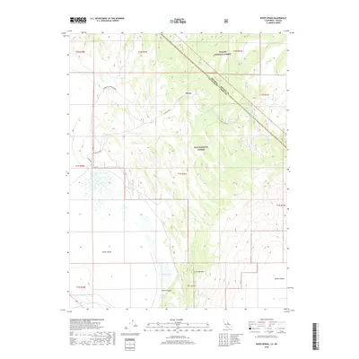
2018 Map of River Spring
USGS Topo · Published 2018About this map
Pizona stands as a focal point in this high-desert landscape, where the California-Nevada state line cuts diagonally across the eastern slopes of the Benton Range. This 2018 survey documents a remote corridor of the Great Basin where life is defined by its water sources, including Pizona Springs, Upper Pizona Spring, and Pizona Hot Springs-North. To the south, the flat expanse of Adobe Valley meets the rising terrain of Antelope Mtn, while Antelope Lake and Antelope Spring mark the lower elevations near Benton Valley. The map illustrates the jurisdictional boundaries of the Toiyabe National Forest and Inyo National Forest, showing the limited road network represented by Pizona Rd and the drainage of Pizona Cr toward McNamara Lake.
Find a feature on this map
25 named features on this map. Tap any name to fly to it.
Don’t see what you’re looking for? This feature index may not catch every label — zoom into the map to look around manually.
Map Details
Editions of this 2018 River Spring Map
This is the sole edition of this map. No revisions or reprints were ever made.
Other maps of this area

1909 · Hawthorne
USGS Topo · 1:250,000

1911 · Hawthorne
USGS Topo · 1:250,000

1914 · Mt. Morrison
USGS Topo · 1:125,000

1915 · Hawthorne
USGS Topo · 1:250,000

1917 · White Mountain
USGS Topo · 1:125,000

1947 · Mariposa
USGS Topo · 1:250,000

1948 · Walker Lake
USGS Topo · 1:250,000

1948 · Mariposa
USGS Topo · 1:250,000

1957 · Walker Lake
USGS Topo · 1:250,000

1957 · Mariposa
USGS Topo · 1:250,000