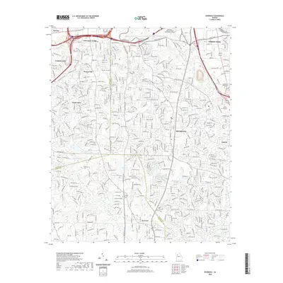
2020 Map of Riverdale
USGS Topo · Published 2020About this map
Riverdale and South Fulton define this landscape south of the urban core, where suburban development meets the historical footprints of Fulton, Clayton, and Fayette counties. The northern edge is dominated by the sprawling infrastructure of Hartsfield-Jackson Atlanta International Airport, while further south, the terrain transitions into a dense network of residential subdivisions and smaller water bodies like Lake Tahoe, Dickson Lake, and Joy Lake. Family and community history is preserved in numerous burial grounds scattered across the quadrangle, including Philadelphia Presbyterian Cem and Carver Memorial Park Cem. Significant arterial routes such as Riverdale Rd and W Fayetteville Rd trace the path of regional growth, connecting established settlements like Kenwood and Pleasant Hill to the expanding metropolitan infrastructure.
Find a feature on this map
68 named features on this map. Tap any name to fly to it.
Don’t see what you’re looking for? This feature index may not catch every label — zoom into the map to look around manually.
Map Details
Editions of this 2020 Riverdale Map
This is the sole edition of this map. No revisions or reprints were ever made.
Other maps of this area

1888 · Atlanta
USGS Topo · 1:125,000

1890 · Atlanta
USGS Topo · 1:125,000

1891 · Marietta
USGS Topo · 1:125,000

1892 · Atlanta
USGS Topo · 1:125,000

1895 · Atlanta
USGS Topo · 1:125,000

1895 · Marietta
USGS Topo · 1:125,000

1897 · Marietta
USGS Topo · 1:125,000

1901 · Marietta
USGS Topo · 1:125,000

1953 · Atlanta
USGS Topo · 1:250,000

1954 · Conley
USGS Topo · 1:24,000