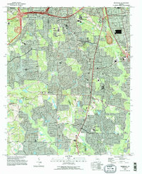
1993 Map of Riverdale
USGS Topo · Published 1995About this map
Riverdale and the surrounding suburbs of south metropolitan Atlanta are documented here during a period of significant residential expansion in the early 1990s. The landscape is a dense network of winding subdivisions and established corridors like Old National Road and Bethsaida Road, illustrating the post-war suburbanization that transformed Clayton, Fulton, and Fayette counties. Despite the growth, older community anchors remain visible, including numerous local congregations such as Philadelphia Ch and Flint Ridge Ch, alongside smaller landmarks like Mundy Cem.
Find a feature on this map
82 named features on this map. Tap any name to fly to it.
Don’t see what you’re looking for? This feature index may not catch every label — zoom into the map to look around manually.
Map Details
Editions of this 1993 Riverdale Map
This is the sole edition of this map. No revisions or reprints were ever made.
Other maps of this area

1888 · Atlanta
USGS Topo · 1:125,000

1890 · Atlanta
USGS Topo · 1:125,000

1891 · Marietta
USGS Topo · 1:125,000

1892 · Atlanta
USGS Topo · 1:125,000

1895 · Atlanta
USGS Topo · 1:125,000

1895 · Marietta
USGS Topo · 1:125,000

1897 · Marietta
USGS Topo · 1:125,000

1901 · Marietta
USGS Topo · 1:125,000

1953 · Atlanta
USGS Topo · 1:250,000

1954 · Conley
USGS Topo · 1:24,000