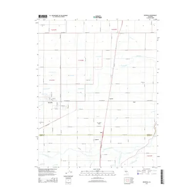
2015 Map of Riverdale
USGS Topo · Published 2015About this map
The settlement of Riverdale sits at the heart of an intricate water-management network in the San Joaquin Valley, defined by a complex system of historic ditches, canals, and sloughs. This 2015 survey illustrates how the landscape around Camden and Clint has been shaped by its proximity to the North Fork Kings River and the South Fork Kings River. Notable irrigation features like Liberty Ditch, Settlers Ditch, and the Grant Canal crisscross the region, supporting the intensive agricultural grid that characterizes Fresno County. Smaller locales such as Hub and Gepford are situated along these vital water routes. For those researching local heritage, the map identifies landmarks like Oak Knoll Cem and traces the natural drainage patterns of Murphy Slough and Fault Slough, providing a detailed view of the hydraulic infrastructure that sustains this portion of the valley.
Find a feature on this map
62 named features on this map. Tap any name to fly to it.
Don’t see what you’re looking for? This feature index may not catch every label — zoom into the map to look around manually.
Map Details
Editions of this 2015 Riverdale Map
This is the sole edition of this map. No revisions or reprints were ever made.
Other maps of this area

1924 · Riverdale
USGS Topo · 1:31,680

1924 · Conejo
USGS Topo · 1:31,680

1925 · Raisin
USGS Topo · 1:31,680

1925 · Caruthers
USGS Topo · 1:31,680

1926 · Hanford
USGS Topo · 1:31,680

1926 · Lethent
USGS Topo · 1:31,680

1927 · Laton
USGS Topo · 1:31,680

1927 · Burrel
USGS Topo · 1:31,680

1927 · Riverdale
USGS Topo · 1:31,680

1927 · Lemoore
USGS Topo · 1:31,680