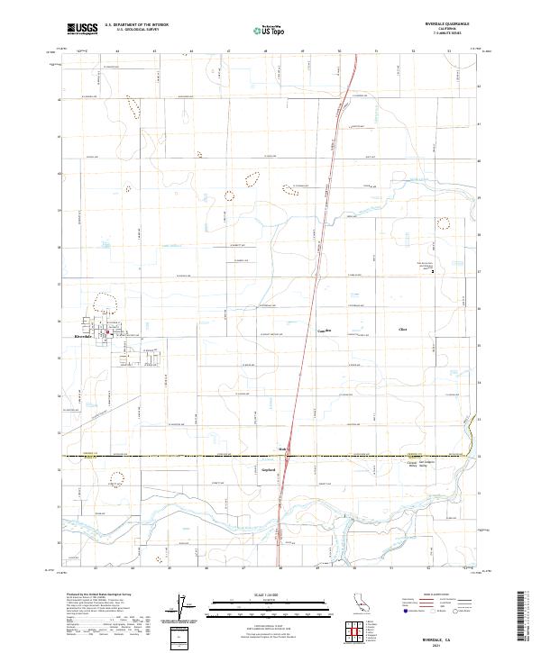
2021 Map of Riverdale
USGS Topo · Published 2021About this map
The Central Valley landscape around Riverdale is defined by an intricate network of water management, where natural channels and man-made canals support the agricultural heart of the San Joaquin Valley. Significant waterways like the North Fork Kings River and South Fork Kings River meander through the southern portion of the quadrangle, joined by named sloughs such as Crooked Slough and Murphy Slough. This complex hydrography is further detailed by the presence of the Settlers Ditch, Little Millrace, and Grant Canal, illustrating the historical and ongoing importance of irrigation to these communities.
Find a feature on this map
98 named features on this map. Tap any name to fly to it.
Don’t see what you’re looking for? This feature index may not catch every label — zoom into the map to look around manually.
Map Details
Editions of this 2021 Riverdale Map
This is the sole edition of this map. No revisions or reprints were ever made.
Other maps of this area

1924 · Riverdale
USGS Topo · 1:31,680

1924 · Conejo
USGS Topo · 1:31,680

1925 · Raisin
USGS Topo · 1:31,680

1925 · Caruthers
USGS Topo · 1:31,680

1926 · Hanford
USGS Topo · 1:31,680

1926 · Lethent
USGS Topo · 1:31,680

1927 · Laton
USGS Topo · 1:31,680

1927 · Burrel
USGS Topo · 1:31,680

1927 · Riverdale
USGS Topo · 1:31,680

1927 · Lemoore
USGS Topo · 1:31,680