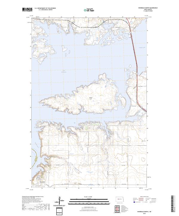
2024 Map of Riverdale North
USGS Topo · Published 2024About this map
Audubon National Wildlife Refuge dominates the eastern landscape of this modern quadrangle, where the massive waters of Lake Sakakawea and Audubon Lake are separated by the Garrison Dam complex just south of the frame. The settlement of Riverdale sits on the high ground overlooking the Missouri River, serving as a key point of reference for the management of these Missouri River reservoirs. The topography is defined by the intricate, flooded fingers of the lakes, most notably around Mallard Island, illustrating the transformation of the Missouri River valley into a major hydraulic and recreational system. Land use is divided between the protected wetlands of the refuge and the rural sections of McLean County, with a grid of local roads like Co Rd 15 and 7th St NW providing access to the coulees and shoreline, including the drainage of Aggie Brown Coulee.
Find a feature on this map
24 named features on this map. Tap any name to fly to it.
Don’t see what you’re looking for? This feature index may not catch every label — zoom into the map to look around manually.
Map Details
Editions of this 2024 Riverdale North Map
This is the sole edition of this map. No revisions or reprints were ever made.
Other maps of this area

1922 · Garrison
USGS Topo · 1:62,500

1929 · Coleharbor
USGS Topo · 1:62,500

1948 · Stanton
USGS Topo · 1:62,500

1949 · Stanton
USGS Topo · 1:62,500

1949 · Washburn
USGS Topo · 1:62,500

1954 · McClusky
USGS Topo · 1:250,000

1958 · McClusky
USGS Topo · 1:250,000

1961 · Underwood
USGS Topo · 1:24,000
1969 · Garrison Dam South
USGS Topo · 1:24,000
1972 · Garrison Dam North
USGS Topo · 1:24,000