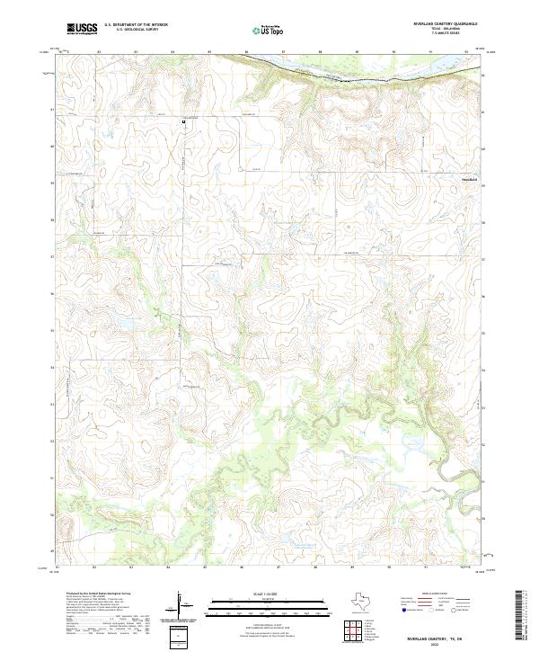
2022 Map of Riverland Cemetery
USGS Topo · Published 2022About this map
The Red River forms the northern boundary of this territory, separating Clay County, Texas, from Jefferson County, Oklahoma. This rural landscape is defined by the winding course of the Little Wichita River as it traverses the southern half of the quadrangle, creating a complex drainage network that includes Little Pecan Cr and several water bodies such as Lively Lake and Maddox Lake. The settlement of Stanfield sits in the northeast, while the interior is crisscrossed by established farm-to-market roads and named routes like Riverland Rd and Jim Maddox Rd.
Find a feature on this map
25 named features on this map. Tap any name to fly to it.
Don’t see what you’re looking for? This feature index may not catch every label — zoom into the map to look around manually.
Map Details
Editions of this 2022 Riverland Cemetery Map
This is the sole edition of this map. No revisions or reprints were ever made.
Other maps of this area

1901 · Addington
USGS Topo · 1:125,000

1905 · Montague
USGS Topo · 1:125,000

1954 · Sherman
USGS Topo · 1:250,000

1954 · Wichita Falls
USGS Topo · 1:250,000

1955 · Lawton
USGS Topo · 1:250,000

1956 · Henrietta
USGS Topo · 1:62,500

1957 · Hastings
USGS Topo · 1:62,500

1957 · Ardmore
USGS Topo · 1:250,000

1958 · Wichita Falls
USGS Topo · 1:250,000

1958 · Sherman
USGS Topo · 1:250,000