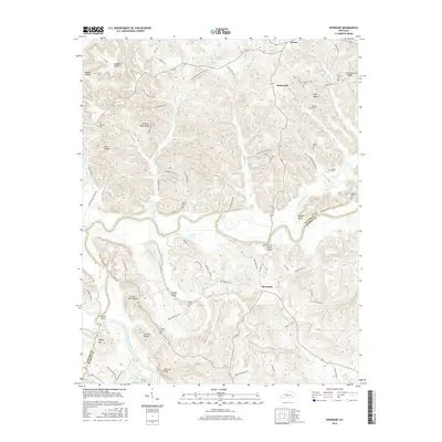
2016 Map of Riverside
USGS Topo · Published 2016About this map
The Green River and Barren River dominate this landscape along the Butler and Warren County line, creating a complex network of ridges and hollows in south-central Kentucky. Small communities like Riverside and Horsemill are connected by a web of narrow roads that follow the high ground, such as Lettered Rock Ridge and Pisgah Ridge. Family history is deeply rooted here, evidenced by numerous small burial grounds including Peyton Cem, Nudger Cem, and Threlkel Cem. The terrain is punctuated by distinctive high points like Roans Knob and Little Barn Knob, which overlook the winding river bends at Sproul Bend. Local hydrology is characterized by numerous small tributaries including Little Muddy Creek and Claylick Cr, while several impoundments such as Upton Lake and Little Martin Lake provide water resources for the rural farmsteads and settlements scattered across the quadrangle.
Find a feature on this map
85 named features on this map. Tap any name to fly to it.
Don’t see what you’re looking for? This feature index may not catch every label — zoom into the map to look around manually.
Map Details
Editions of this 2016 Riverside Map
This is the sole edition of this map. No revisions or reprints were ever made.
Other maps of this area

1914 · Little Muddy
USGS Topo · 1:62,500

1922 · Leitchfield
USGS Topo · 1:48,000

1922 · Brownsville
USGS Topo · 1:62,500

1923 · Brownsville
USGS Topo · 1:62,500

1925 · Spring Lick
USGS Topo · 1:62,500

1925 · Leitchfield
USGS Topo · 1:62,500

1953 · Ready
USGS Topo · 1:24,000

1954 · Evansville
USGS Topo · 1:250,000

1954 · Bowling Green North
USGS Topo · 1:24,000

1954 · Welchs Creek
USGS Topo · 1:24,000