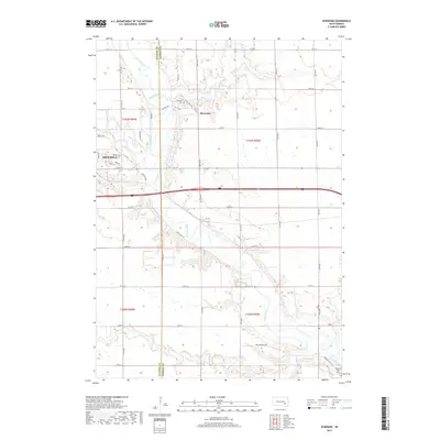
2017 Map of Riverside
USGS Topo · Published 2017About this map
The James River meanders across this landscape, defining the topography east of Mitchell where the city's suburban edge meets the section-line roads of the South Dakota prairie. The terrain is deeply etched by a network of tributaries, including Rock Creek, Firesteel Creek, and Enemy Cr, which carve through the plains to join the main river valley. This 2017 survey details the boundary between Davison and Hanson counties, capturing the modern rural-urban interface. Notable landmarks for genealogical research include Holiness Cem near the settlement of Riverside and Rosedale Cem in the southeastern corner. The map also traces established travel routes like Old Mill Rd and Ben Cummings Rd, reflecting a landscape still anchored by its historical agricultural and water-oriented development patterns.
Find a feature on this map
37 named features on this map. Tap any name to fly to it.
Don’t see what you’re looking for? This feature index may not catch every label — zoom into the map to look around manually.
Map Details
Editions of this 2017 Riverside Map
This is the sole edition of this map. No revisions or reprints were ever made.
Other maps of this area

1899 · Mitchell
USGS Topo · 1:125,000

1899 · Alexandria
USGS Topo · 1:125,000

1955 · Sioux Falls
USGS Topo · 1:250,000

1955 · Mitchell
USGS Topo · 1:250,000

1957 · Alexandria
USGS Topo · 1:24,000

1957 · Ethan
USGS Topo · 1:24,000

1957 · Loomis
USGS Topo · 1:24,000

1957 · Rockport Colony
USGS Topo · 1:24,000

1957 · Riverside
USGS Topo · 1:24,000

1957 · Farwell
USGS Topo · 1:24,000