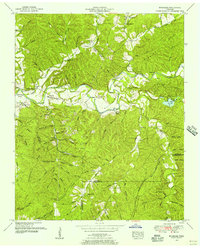
1951 Map of Riverside
USGS Topo · Published 1956About this map
The Buffalo River snakes through this 1951 topographic survey, defining a landscape of deep hollows and sharp ridges at the intersection of Lewis, Lawrence, and Wayne counties. The waterway's path is marked by dramatic bends, including Churchwell Bend and Voorhies Bend, with the low-lying Texas Bottoms adjacent to the settlement of Riverside. This era in the Tennessee hills shows a blend of traditional rural life and active extraction, evidenced by the extensive strip mines located south of Providence.
Find a feature on this map
77 named features on this map. Tap any name to fly to it.
Don’t see what you’re looking for? This feature index may not catch every label — zoom into the map to look around manually.
Map Details
Editions of this 1951 Riverside Map
3 editions found
Other maps of this area

1901 · Colombia
USGS Topo · 1:125,000

1905 · Waynesboro
USGS Topo · 1:125,000

1936 · Riverside
USGS Topo · 1:24,000

1936 · Graves Spring
USGS Topo · 1:24,000

1936 · Deerfield
USGS Topo · 1:24,000

1936 · Henryville
USGS Topo · 1:24,000

1936 · Negro Hollow
USGS Topo · 1:24,000

1936 · Kimmins
USGS Topo · 1:24,000

1936 · Topsy
USGS Topo · 1:24,000

1936 · Gordonsburg
USGS Topo · 1:24,000