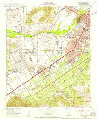
1953 Map of Riverside West
USGS Topo · Published 1955About this map
Santa Ana River hydrology and historic Spanish land grants define the landscape of western Riverside during this mid-century period of transition. The map captures the interface between industrial agriculture and post-war suburban expansion, clearly marking the boundaries of the La Sierra (Sepulveda) Grant Bdy and Jurupa Grant Boundary. Prominent institutional sites like the Sherman Indian Institute, the California School for the Deaf, and the County Farm appear alongside established neighborhoods such as Arlington and Casa Blanca.
Find a feature on this map
63 named features on this map. Tap any name to fly to it.
Don’t see what you’re looking for? This feature index may not catch every label — zoom into the map to look around manually.
Map Details
Editions of this 1953 Riverside West Map
2 editions found
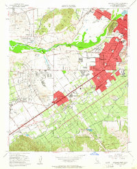
Other maps of this area

1896 · San Bernardino
USGS Topo · 1:62,500

1897 · Cucamonga
USGS Topo · 1:62,500

1898 · San Bernardino
USGS Topo · 1:62,500

1900 · Cucamonga
USGS Topo · 1:62,500

1901 · Southern California Sheet No. 1
USGS Topo · 1:250,000

1901 · San Bernardino
USGS Topo · 1:62,500

1901 · Elsinore
USGS Topo · 1:125,000

1901 · Riverside
USGS Topo · 1:62,500

1902 · Corona
USGS Topo · 1:125,000

1903 · Cucamonga
USGS Topo · 1:62,500