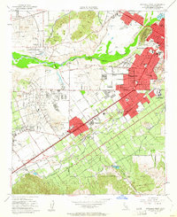
1953 Map of Riverside West
USGS Topo · Published 1962About this map
Mount Rubidoux stands as a prominent landmark over the bend of the Santa Ana River, anchoring a landscape in mid-century transition. The city of Riverside expands southward through Magnolia Center and Casa Blanca, with the built-up areas indicated by the red tint and concentrated around established transit corridors. Education and social institutions form the backbone of the community, ranging from the specialized Sherman Indian Institute and California School for the Deaf to the campus of Riverside College. Further west, the map details agricultural and residential shifts near Arlington and Arlanza Village, while the rail operations of the Union Pacific Railroad and the Pacific Electric line at Arlington Station illustrate the importance of commercial transport. The northern hills around Pedley and the southern slopes of the Sierra De San Jacinto provide a topographic frame to this valley of citrus groves and growing suburbs.
Find a feature on this map
68 named features on this map. Tap any name to fly to it.
Don’t see what you’re looking for? This feature index may not catch every label — zoom into the map to look around manually.
Map Details
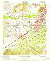
Editions of this 1953 Riverside West Map
2 editions found
Other maps of this area

1896 · San Bernardino
USGS Topo · 1:62,500

1897 · Cucamonga
USGS Topo · 1:62,500

1898 · San Bernardino
USGS Topo · 1:62,500

1900 · Cucamonga
USGS Topo · 1:62,500

1901 · Southern California Sheet No. 1
USGS Topo · 1:250,000

1901 · San Bernardino
USGS Topo · 1:62,500

1901 · Elsinore
USGS Topo · 1:125,000

1901 · Riverside
USGS Topo · 1:62,500

1902 · Corona
USGS Topo · 1:125,000

1903 · Cucamonga
USGS Topo · 1:62,500