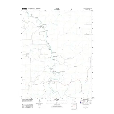
2011 Map of Riverton
USGS Topo · Published 2011About this map
The Eleven Point River carves a deep path through this portion of Oregon County, Missouri, serving as the central artery for both recreation and historical settlement. The landscape is defined by an intricate network of tributary hollows, including Graveyard Hollow, Stillhouse Hollow, and Midnight Hollow, which drain into the river corridor. This 2011 survey highlights the area's dual character as a protected natural resource and a place of local history, where features like the Boze Mill and the Coin Post Office stand as markers of earlier industry and community life.
Find a feature on this map
64 named features on this map. Tap any name to fly to it.
Don’t see what you’re looking for? This feature index may not catch every label — zoom into the map to look around manually.
Map Details
Editions of this 2011 Riverton Map
This is the sole edition of this map. No revisions or reprints were ever made.
Other maps of this area

1931 · Bandyville
USGS Topo · 1:48,000

1941 · Gatewood
USGS Topo · 1:62,500

1944 · Van Buren
USGS Topo · 1:62,500

1944 · Couch
USGS Topo · 1:62,500

1944 · Birch Tree
USGS Topo · 1:62,500

1945 · Gatewood
USGS Topo · 1:62,500

1946 · Couch
USGS Topo · 1:62,500

1946 · Van Buren
USGS Topo · 1:62,500

1948 · Birch Tree
USGS Topo · 1:62,500

1957 · Poplar Bluff
USGS Topo · 1:250,000