
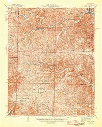
1946 Map of Van Buren
USGS Topo · Published 1946About this map
The Current River carves through the Ozark landscape of Carter County in the mid-1940s, serving as a focal point for local activity near Chicopee. This era shows the extensive reach of the Clark National Forest and the Wilderness State Game Refuge, illustrating a region defined by conservation and timber. The St Louis - San Francisco RR follows the northern corridor through Fremont, connecting these timberlands to larger markets.
Find a feature on this map
61 named features on this map. Tap any name to fly to it.
Don’t see what you’re looking for? This feature index may not catch every label — zoom into the map to look around manually.
Map Details
Editions of this 1946 Van Buren Map
2 editions found
Other maps of this area

1915 · Eminence
USGS Topo · 1:62,500

1917 · Eminence
USGS Topo · 1:62,500

1928 · Cardareva
USGS Topo · 1:62,500

1931 · Bandyville
USGS Topo · 1:48,000

1939 · Doniphan
USGS Topo · 1:62,500

1941 · Gatewood
USGS Topo · 1:62,500

1943 · Ellington
USGS Topo · 1:62,500

1944 · Van Buren
USGS Topo · 1:62,500

1944 · Couch
USGS Topo · 1:62,500

1944 · Birch Tree
USGS Topo · 1:62,500