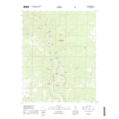
2017 Map of Riverton
USGS Topo · Published 2017About this map
Boze Mill sits at a sharp bend in the Eleven Point River, serving as a central landmark for this portion of the Mark Twain National Forest. The landscape is defined by its extensive system of hollows and springs, many of which carry names that suggest early local industry and community life, such as Stillhouse Hollow and Schoolhouse Hollow. Near the settlement of Riverton, the terrain is exceptionally varied with features like Turtle Island Hollow and the notable Boze Mill Spring. This area of Oregon County shows a complex network of county roads like Co RD 152 and Co RD 147 that navigate around prominent landforms like Turkey Knob and Conner Hill, reflecting the deep-seated rural character of the Missouri Ozarks.
Find a feature on this map
63 named features on this map. Tap any name to fly to it.
Don’t see what you’re looking for? This feature index may not catch every label — zoom into the map to look around manually.
Map Details
Editions of this 2017 Riverton Map
This is the sole edition of this map. No revisions or reprints were ever made.
Other maps of this area

1931 · Bandyville
USGS Topo · 1:48,000

1941 · Gatewood
USGS Topo · 1:62,500

1944 · Van Buren
USGS Topo · 1:62,500

1944 · Couch
USGS Topo · 1:62,500

1944 · Birch Tree
USGS Topo · 1:62,500

1945 · Gatewood
USGS Topo · 1:62,500

1946 · Couch
USGS Topo · 1:62,500

1946 · Van Buren
USGS Topo · 1:62,500

1948 · Birch Tree
USGS Topo · 1:62,500

1957 · Poplar Bluff
USGS Topo · 1:250,000