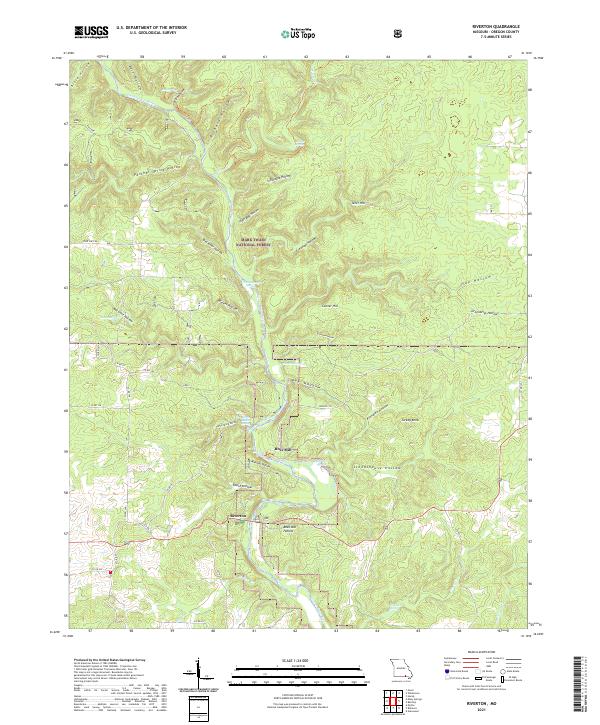
2021 Map of Riverton
USGS Topo · Published 2021About this map
The Eleven Point River carves a deep path through Oregon County, Missouri, anchoring a landscape defined by the Mark Twain National Forest. The settlement of Riverton serves as a focal point for the region, positioned near the river's edge. This modern survey illustrates the enduring agricultural and industrial heritage of the area, most notably at the site of Boze Mill. The topography is heavily dissected by numerous hollows, such as Panther Spring Hollow, Stillhouse Hollow, and Orchard Hollow, which highlight the complex hydrology of the Ozarks.
Find a feature on this map
58 named features on this map. Tap any name to fly to it.
Don’t see what you’re looking for? This feature index may not catch every label — zoom into the map to look around manually.
Map Details
Editions of this 2021 Riverton Map
This is the sole edition of this map. No revisions or reprints were ever made.
Other maps of this area

1931 · Bandyville
USGS Topo · 1:48,000

1941 · Gatewood
USGS Topo · 1:62,500

1944 · Van Buren
USGS Topo · 1:62,500

1944 · Couch
USGS Topo · 1:62,500

1944 · Birch Tree
USGS Topo · 1:62,500

1945 · Gatewood
USGS Topo · 1:62,500

1946 · Couch
USGS Topo · 1:62,500

1946 · Van Buren
USGS Topo · 1:62,500

1948 · Birch Tree
USGS Topo · 1:62,500

1957 · Poplar Bluff
USGS Topo · 1:250,000