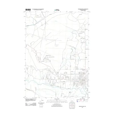
2012 Map of Riverton West
USGS Topo · Published 2012About this map
The Wind River defines the southern reach of this landscape, supporting a complex network of man-made waterways essential to the region's development. Features like the Wyoming Central Canal, Pilot Canal, and Lefthand Ditch illustrate a concerted effort to manage water across the arid Wyoming terrain. The western outskirts of Riverton show the city's growth, including the residential area of Riverview Valley and the expansive grounds of the Riverton Regional Airport. Local history is anchored by the presence of Mountain View Cem and the Odd Fellows Cem, providing important touchstones for genealogical research. The transition from the structured streets of the city to the open agricultural land is marked by natural features like Berlin Draw and Haymaker Cr, showcasing the balance between urban expansion and the high plains environment.
Find a feature on this map
124 named features on this map. Tap any name to fly to it.
Don’t see what you’re looking for? This feature index may not catch every label — zoom into the map to look around manually.
Map Details
Editions of this 2012 Riverton West Map
This is the sole edition of this map. No revisions or reprints were ever made.
Other maps of this area

1950 · Riverton East
USGS Topo · 1:24,000

1950 · Ocean Lake
USGS Topo · 1:24,000

1951 · Pavillion SE
USGS Topo · 1:24,000

1951 · Riverton West
USGS Topo · 1:24,000

1952 · Riverton NE
USGS Topo · 1:24,000

1952 · Lost Wells Butte
USGS Topo · 1:24,000

1952 · Hudson
USGS Topo · 1:24,000

1953 · Arapahoe NE
USGS Topo · 1:24,000

1953 · Arapahoe
USGS Topo · 1:24,000

1955 · Thermopolis
USGS Topo · 1:250,000