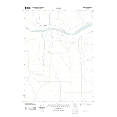
2011 Map of Riverview
USGS Topo · Published 2011About this map
The Niobrara River carves a significant east-west path through this part of Keya Paha County, defining the local geography with its braided channels and features like Kindall Island. Near the northern banks, the small settlement of Riverview sits at the junction of several drainage systems, including Wyman Creek and Wentworth Creek. The surrounding landscape is characterized by a high density of north-flowing tributaries that feed into the Niobrara, such as Sand Creek, Elk Creek, and Coon Creek. This drainage pattern reveals the dissected nature of the plains in northern Nebraska, where the river serves as the primary topographical anchor for the sparse road networks and agricultural land divisions shown in this 2011 survey.
Find a feature on this map
10 named features on this map. Tap any name to fly to it.
Don’t see what you’re looking for? This feature index may not catch every label — zoom into the map to look around manually.
Map Details
Editions of this 2011 Riverview Map
This is the sole edition of this map. No revisions or reprints were ever made.
Other maps of this area

1949 · Jamison SW
USGS Topo · 1:24,000

1949 · Riverview
USGS Topo · 1:24,000

1949 · Carns
USGS Topo · 1:24,000

1950 · Bassett NW
USGS Topo · 1:24,000

1950 · Carns
USGS Topo · 1:24,000

1950 · Riverview
USGS Topo · 1:24,000

1951 · Jamison SW
USGS Topo · 1:24,000

1954 · Long Pine
USGS Topo · 1:24,000

1954 · Bassett
USGS Topo · 1:24,000

1954 · Newport SW
USGS Topo · 1:24,000