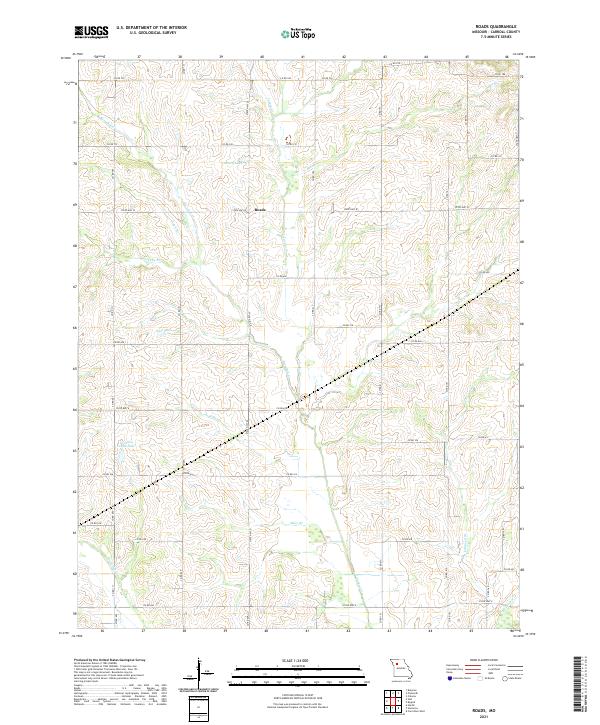
2021 Map of Roads
USGS Topo · Published 2021About this map
Roads serves as the central hub for this rural Carroll County landscape, situated at the intersection of State Hwy W and State Hwy D. The terrain is defined by a dense network of seasonal and perennial waterways that drain toward the south, including Wakenda Cr and its many tributaries like Miles Br and Judd Br. This hydraulic pattern has shaped the development of local agriculture and property lines, which are traced here alongside a comprehensive grid of county roads such as Co Rd 606 and Co Rd 732.
Find a feature on this map
35 named features on this map. Tap any name to fly to it.
Don’t see what you’re looking for? This feature index may not catch every label — zoom into the map to look around manually.
Map Details
Editions of this 2021 Roads Map
This is the sole edition of this map. No revisions or reprints were ever made.
Other maps of this area

1889 · Lexington
USGS Topo · 1:125,000

1924 · Dawn
USGS Topo · 1:62,500

1924 · Braymer
USGS Topo · 1:62,500

1950 · Coloma
USGS Topo · 1:24,000

1950 · Plymouth
USGS Topo · 1:24,000

1951 · Utica
USGS Topo · 1:62,500

1953 · Moberly
USGS Topo · 1:250,000

1954 · Moberly
USGS Topo · 1:250,000
1956 · Carrollton West
USGS Topo · 1:24,000

1957 · Moberly
USGS Topo · 1:250,000