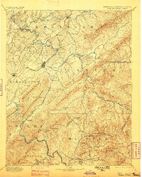
1894 Map of Roan Mountain
USGS Topo · Published 1898About this map
Elizabethton and Johnson serve as focal points in this late 19th-century study of the borderlands between Tennessee and North Carolina. The landscape is defined by the high elevations of the Blue Ridge, dominated by Holston Mountain and the massive profile of Roan Mt, where Roan High Knob and Roan High Bluff stand near the state line. Below these peaks, a network of river crossings illustrates the era's reliance on ferries and fords before modern bridging, with named sites such as Shipley Ferry, Yoakley Ferry, and Devault Ford facilitating travel along the South Fork Holston River and Watauga River.
Find a feature on this map
97 named features on this map. Tap any name to fly to it.
Don’t see what you’re looking for? This feature index may not catch every label — zoom into the map to look around manually.
Map Details
Editions of this 1894 Roan Mountain Map
3 editions found
Other maps of this area

1891 · Roan Mountain
USGS Topo · 1:125,000

1891 · Abingdon
USGS Topo · 1:125,000

1892 · Greeneville
USGS Topo · 1:125,000

1893 · Cranberry
USGS Topo · 1:125,000

1894 · Asheville
USGS Topo · 1:125,000

1894 · Roan Mountain
USGS Topo · 1:125,000

1894 · Abingdon
USGS Topo · 1:125,000

1894 · Estillville
USGS Topo · 1:125,000

1895 · Cranberry
USGS Topo · 1:125,000

1896 · Greeneville
USGS Topo · 1:125,000