Loading...
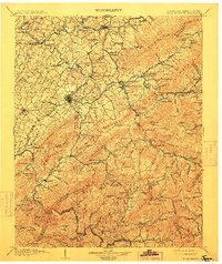
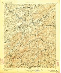
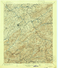
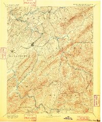
Loading map...1904 Map of Roan Mountain
USGS Topo · Published 1912About this map
Elizabethon and Johnson City serve as the primary urban hubs in this 1904 survey, which documents the industrial and natural geography of the Tennessee-North Carolina border. The landscape is defined by the convergence of the Watauga River and Holston River, with the Southern Ry and the East Tennessee and Western North Carolina RR providing critical transport through the gaps of the Unaka Mountains.
Find a feature on this map
179 named features on this map. Tap any name to fly to it.
Don’t see what you’re looking for? This feature index may not catch every label — zoom into the map to look around manually.
Map Details
Date Portrayed1904
Date Published1912
PublisherU.S. Geological Survey
Map TypeTopographic
Scale1:125,000
Physical Dimensions16.77 x 19.92 inches
Editions of this 1904 Roan Mountain Map
4 editions found

Historical Maps of Johnson City Through Time
3 maps found

Featured Locations
Source Details
SourceU.S. Geological Survey
CopyrightPublic Domain