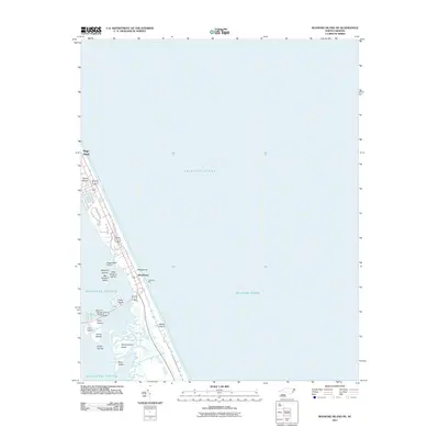
2011 Map of Roanoke Island NE
USGS Topo · Published 2011About this map
Nags Head and the surrounding Outer Banks communities define this coastal area where the Atlantic Ocean meets the intricate wetlands of the Roanoke Sound. The map documents the developed shoreline of Whalebone and Seven Sisters, highlighting the narrow barrier island geography that has long shaped North Carolina's maritime history. Key infrastructure connecting these islands is visible, such as the Melvin R Daniels Bridge spanning the sound and Jeanettes Pier reaching into the surf. The interior waters are dotted with numerous small landforms, including the Penguins Islands, Green Islands, and House Island. These features illustrate the shifting, fragile nature of the sound-side ecosystem, where marshes and small islands like Headquarters Island and Bells Island buffer the mainland from the Atlantic.
Find a feature on this map
19 named features on this map. Tap any name to fly to it.
Don’t see what you’re looking for? This feature index may not catch every label — zoom into the map to look around manually.
Map Details
Editions of this 2011 Roanoke Island NE Map
This is the sole edition of this map. No revisions or reprints were ever made.
Other maps of this area

1940 · Kitty Hawk
USGS Topo · 1:62,500

1943 · Roanoke Island
USGS Topo · 1:125,000

1946 · Eastville
USGS Topo · 1:250,000

1946 · Currituck Sound
USGS Topo · 1:250,000

1953 · Wanchese
USGS Topo · 1:24,000

1953 · Roanoke Island NE
USGS Topo · 1:24,000

1953 · Manteo
USGS Topo · 1:24,000

1955 · Wanchese
USGS Topo · 1:250,000

1957 · Manteo
USGS Topo · 1:250,000

1960 · Manteo
USGS Topo · 1:250,000