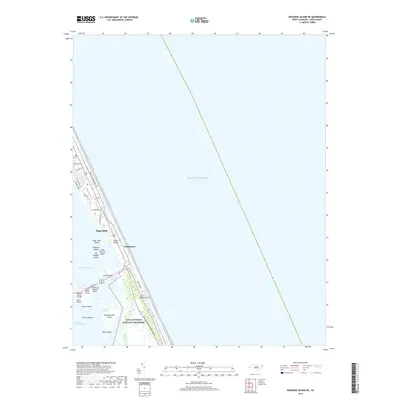
2019 Map of Roanoke Island NE
USGS Topo · Published 2019About this map
The Outer Banks of Dare County are defined here by the thin ribbon of land separating the Atlantic Ocean from the intricate wetlands of Roanoke Sound. This landscape is centered on the coastal settlement of Nags Head and the transition into the protected expanse of the Cape Hatteras National Seashore. The map documents the modern infrastructure connecting these barrier islands, including the Melvin R Daniels Bridge and Roanoke Sound Bridge, which facilitate travel across the sound to Roanoke Island. Further south, the terrain dissolves into the Bodie Island Marshes and a series of small landforms like Cedar Island and Headquarters Island. Along the oceanfront, local residential and access routes such as S Virginia Dare Trl and S Old Oregon trace the shoreline through Whalebone and the residential area of Seven Sisters.
Find a feature on this map
34 named features on this map. Tap any name to fly to it.
Don’t see what you’re looking for? This feature index may not catch every label — zoom into the map to look around manually.
Map Details
Editions of this 2019 Roanoke Island NE Map
This is the sole edition of this map. No revisions or reprints were ever made.
Other maps of this area

1940 · Kitty Hawk
USGS Topo · 1:62,500

1943 · Roanoke Island
USGS Topo · 1:125,000

1946 · Eastville
USGS Topo · 1:250,000

1946 · Currituck Sound
USGS Topo · 1:250,000

1953 · Wanchese
USGS Topo · 1:24,000

1953 · Roanoke Island NE
USGS Topo · 1:24,000

1953 · Manteo
USGS Topo · 1:24,000

1955 · Wanchese
USGS Topo · 1:250,000

1957 · Manteo
USGS Topo · 1:250,000

1960 · Manteo
USGS Topo · 1:250,000