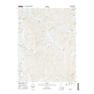
2016 Map of Roanoke
USGS Topo · Published 2016About this map
Alkires Mills and Roanoke anchor this study of central West Virginia, where the landscape is defined by the winding drainages of the West Fork River. The terrain is characterized by a dense network of runs and hollows, including Rohrbough Hollow and Coal Hollow, which feed into larger water bodies like the Stonecoal Reservoir in the northeast. Numerous small settlements such as Vandalia, Jacksonville, and Georgetown are connected by a web of local routes like Skin Creek Rd and Glady Road. Local history and genealogy are well-represented by several family and community burial grounds, including the Rockford-Pletcher Cem and Fairview Cem. The map illustrates the persistent settlement patterns of Lewis County, where modern infrastructure like Roanoke Bay State Park Trl meets long-established landmarks like Wolf Fork Mtn and Bald Knob.
Find a feature on this map
120 named features on this map. Tap any name to fly to it.
Don’t see what you’re looking for? This feature index may not catch every label — zoom into the map to look around manually.
Map Details
Editions of this 2016 Roanoke Map
This is the sole edition of this map. No revisions or reprints were ever made.
Other maps of this area

1893 · Buckhannon
USGS Topo · 1:125,000

1893 · Sutton
USGS Topo · 1:125,000

1896 · Buckhannon
USGS Topo · 1:125,000

1897 · Buckhannon
USGS Topo · 1:125,000

1904 · Weston
USGS Topo · 1:62,500

1904 · Vadis
USGS Topo · 1:62,500

1906 · Burnsville
USGS Topo · 1:62,500

1912 · Crawford
USGS Topo · 1:48,000

1914 · Crawford
USGS Topo · 1:62,500

1925 · Burnsville
USGS Topo · 1:62,500