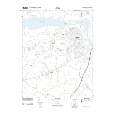
2010 Map of Roanoke Rapids
USGS Topo · Published 2010About this map
Roanoke Rapids Lake and the Roanoke River dominate this landscape, controlled by the Roanoke Rapids Lake Dam and several smaller structures like the Rochelle Pond Dam. The city of Roanoke Rapids is surrounded by established neighborhoods and satellite communities including Belmont, Rosemary, and South Rosemary. This 2010 survey shows a developed infrastructure defined by the Halifax County Airport and a dense network of local roads such as Sam Powell Dairy Rd and Piney Grove Church Rd.
Find a feature on this map
60 named features on this map. Tap any name to fly to it.
Don’t see what you’re looking for? This feature index may not catch every label — zoom into the map to look around manually.
Map Details
Editions of this 2010 Roanoke Rapids Map
This is the sole edition of this map. No revisions or reprints were ever made.
Other maps of this area

1919 · White Plains
USGS Topo · 1:48,000

1919 · Emporia
USGS Topo · 1:62,500

1920 · White Plains
USGS Topo · 1:62,500

1942 · Emporia
USGS Topo · 1:62,500

1953 · Norfolk
USGS Topo · 1:250,000

1963 · Skippers
USGS Topo · 1:24,000

1963 · Barley
USGS Topo · 1:24,000

1963 · Valentines
USGS Topo · 1:24,000

1973 · Aurelian Springs
USGS Topo · 1:24,000
1973 · Thelma
USGS Topo · 1:24,000