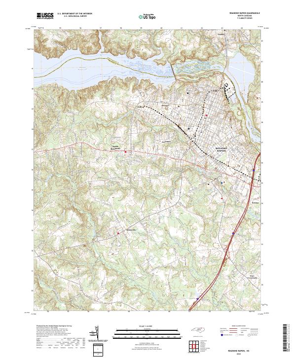
2022 Map of Roanoke Rapids
USGS Topo · Published 2022About this map
Roanoke Rapids and its surrounding textile-era neighborhoods like Rosemary and Belmont anchor this modern survey along the Roanoke River. The industrial and residential layout follows the curve of the river, with the massive impoundment of Roanoke Rapids Lake defining the northern landscape. Local history is well-preserved through several named burial grounds, including Cedarwood Cem and Poplar Grove Cem near the river, and Crestview Memorial Cem further south. The map illustrates a distinct urban-to-rural transition, moving from the dense street grids of the main town to the outlying clusters of South Rosemary, Rheasville, and Days Crossroads. Water bodies like Chockoyotte Cr and Quankey Cr carve through the terrain south of the river, reflecting the local drainage patterns that shaped the growth of Weldon and Gaston.
Find a feature on this map
195 named features on this map. Tap any name to fly to it.
Don’t see what you’re looking for? This feature index may not catch every label — zoom into the map to look around manually.
Map Details
Editions of this 2022 Roanoke Rapids Map
This is the sole edition of this map. No revisions or reprints were ever made.
Other maps of this area

1919 · White Plains
USGS Topo · 1:48,000

1919 · Emporia
USGS Topo · 1:62,500

1920 · White Plains
USGS Topo · 1:62,500

1942 · Emporia
USGS Topo · 1:62,500

1953 · Norfolk
USGS Topo · 1:250,000

1963 · Skippers
USGS Topo · 1:24,000

1963 · Barley
USGS Topo · 1:24,000

1963 · Valentines
USGS Topo · 1:24,000

1973 · Aurelian Springs
USGS Topo · 1:24,000
1973 · Thelma
USGS Topo · 1:24,000