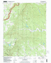
1997 Map of Roaring Gap
USGS Topo · Published 2000About this map
The Blue Ridge Parkway winds through the high elevations of the northwest corner of this map, tracing the divide where the mountains meet the Piedmont. This late 20th-century landscape is defined by its rural communities and water systems, where the Mitchell River and its numerous tributaries like South Fork Mitchell River and Chadric Creek carve through the Little Mountain and Blue Ridge terrain. The settlement at Roaring Gap sits near a prominent Fish Hatchery, while several country churches, including Antioch Ch and Mt View Ch, serve as local centers of gravity.
Find a feature on this map
43 named features on this map. Tap any name to fly to it.
Don’t see what you’re looking for? This feature index may not catch every label — zoom into the map to look around manually.
Map Details
Editions of this 1997 Roaring Gap Map
This is the sole edition of this map. No revisions or reprints were ever made.
Other maps of this area

1889 · Hillsville
USGS Topo · 1:125,000

1889 · Wytheville
USGS Topo · 1:125,000

1889 · Wilkesboro
USGS Topo · 1:125,000

1891 · Wilkesboro
USGS Topo · 1:125,000

1891 · Yadkinville
USGS Topo · 1:125,000

1892 · Hillsville
USGS Topo · 1:125,000

1892 · Wytheville
USGS Topo · 1:125,000

1893 · Yadkinville
USGS Topo · 1:125,000

1896 · Hillsville
USGS Topo · 1:125,000

1930 · Independence
USGS Topo · 1:48,000