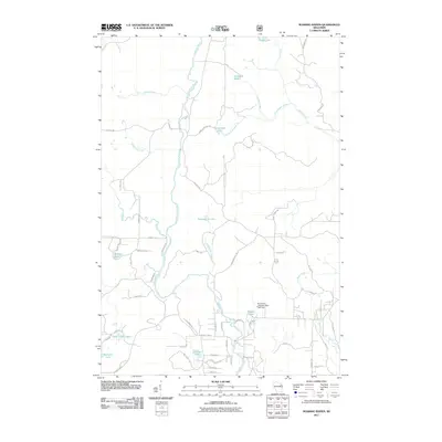
2011 Map of Roaring Rapids
USGS Topo · Published 2011About this map
The Peshtigo River meanders through this northwoods Wisconsin landscape, defining a terrain shaped by water and timber. The river's flow is managed in the southern reach of this area by the Hoyle and Johnson 3WR-1647 Dam, located just upstream from its junction with Little Eagle Creek. The map documents a dense network of forest roads and residential lanes, such as Hemlock Shores Rd and Woodcock Ln, which suggest a community oriented around the numerous glacial lakes.
Find a feature on this map
60 named features on this map. Tap any name to fly to it.
Don’t see what you’re looking for? This feature index may not catch every label — zoom into the map to look around manually.
Map Details
Editions of this 2011 Roaring Rapids Map
This is the sole edition of this map. No revisions or reprints were ever made.
Other maps of this area

1939 · Dunbar
USGS Topo · 1:48,000

1939 · Goodman
USGS Topo · 1:48,000

1940 · Thunder Mtn.
USGS Topo · 1:48,000

1940 · Athelstane
USGS Topo · 1:48,000

1941 · Dunbar
USGS Topo · 1:48,000

1942 · Athelstane
USGS Topo · 1:48,000

1946 · Goodman
USGS Topo · 1:48,000

1947 · Dunbar
USGS Topo · 1:48,000

1951 · Thunder Mountain
USGS Topo · 1:48,000

1954 · Iron Mountain
USGS Topo · 1:250,000