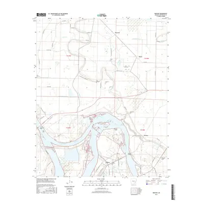
2017 Map of Rob Roy
USGS Topo · Published 2017About this map
The Arkansas River carves a winding path through this agricultural landscape, defining the character of communities like Rob Roy and Wilkins. The river's influence is evident in the complex network of drainage channels such as Waterloo Drainage Ditch, Black Bayou Lateral, and the Old Channel Plum Bayou. Dramatic river features including Sainte Marie Bend, Yell Bend, and the Boyd Point Cutoff illustrate the shifting nature of the waterway. Transportation history is anchored by the Jefferson County Free Bridge and the Rob Roy Bridge, which connect the dispersed settlements and farms.
Find a feature on this map
72 named features on this map. Tap any name to fly to it.
Don’t see what you’re looking for? This feature index may not catch every label — zoom into the map to look around manually.
Map Details
Editions of this 2017 Rob Roy Map
This is the sole edition of this map. No revisions or reprints were ever made.
Other maps of this area

1932 · Pastoria
USGS Topo · 1:62,500

1935 · Altheimer
USGS Topo · 1:62,500

1935 · Pastoria
USGS Topo · 1:62,500

1935 · Noble Lake
USGS Topo · 1:62,500

1948 · Helena
USGS Topo · 1:250,000

1950 · Helena
USGS Topo · 1:250,000

1955 · Helena
USGS Topo · 1:250,000

1955 · Little Rock
USGS Topo · 1:250,000

1956 · Little Rock
USGS Topo · 1:250,000

1959 · Helena
USGS Topo · 1:250,000