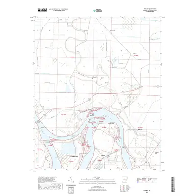
2020 Map of Rob Roy
USGS Topo · Published 2020About this map
The Arkansas River carves a complex course through this portion of Jefferson County, defining the landscape between the northeastern edge of Pine Bluff and the settlement of Rob Roy. Significant hydrological features like the Boyd Point Cutoff and Winfrey Reach reveal the active management and natural shifting of the river channel, which is also characterized by the broad Sainte Marie Bend and Rob Roy Shoal. The map captures a mix of industrial river access and agricultural land, with various bayous such as Black Bayou and Flat Bayou draining the surrounding bottoms.
Find a feature on this map
70 named features on this map. Tap any name to fly to it.
Don’t see what you’re looking for? This feature index may not catch every label — zoom into the map to look around manually.
Map Details
Editions of this 2020 Rob Roy Map
This is the sole edition of this map. No revisions or reprints were ever made.
Other maps of this area

1932 · Pastoria
USGS Topo · 1:62,500

1935 · Altheimer
USGS Topo · 1:62,500

1935 · Pastoria
USGS Topo · 1:62,500

1935 · Noble Lake
USGS Topo · 1:62,500

1948 · Helena
USGS Topo · 1:250,000

1950 · Helena
USGS Topo · 1:250,000

1955 · Helena
USGS Topo · 1:250,000

1955 · Little Rock
USGS Topo · 1:250,000

1956 · Little Rock
USGS Topo · 1:250,000

1959 · Helena
USGS Topo · 1:250,000