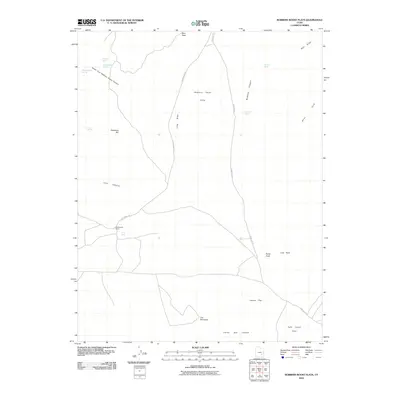
2010 Map of Robbers Roost Flats
USGS Topo · Published 2010About this map
Robbers Roost Flats and the surrounding high desert of Wayne County appear here in detail, centered on a network of remote ranching roads and ancient drainage systems. The landscape is defined by its water sources, where vital points like Robbers Roost Spring, Crow Seep, and Silvertip Spring provided lifeblood for livestock and travelers in an arid environment. Human activity is anchored by the Biddlecome Ranch, situated along Ekker Ranch Rd. This area has long served as a corridor for movement across the desert, as evidenced by Hans Flat Rd traversing the eastern portion of the map. Dramatic geological features cut through the flats, including the deep South Fork Robbers Roost Canyon and Bluejohn Canyon. To the south, the terrain becomes increasingly complex near The Pinnacles and Corral Box Canyon, illustrating the transition from open plateaus to the intricate canyon systems that characterize this part of the Colorado Plateau.
Find a feature on this map
25 named features on this map. Tap any name to fly to it.
Don’t see what you’re looking for? This feature index may not catch every label — zoom into the map to look around manually.
Map Details
Editions of this 2010 Robbers Roost Flats Map
This is the sole edition of this map. No revisions or reprints were ever made.
Other maps of this area

1885 · San Rafael
USGS Topo · 1:250,000

1953 · Orange Cliffs 4 NW
USGS Topo · 1:24,000

1953 · Orange Cliffs 3 NE
USGS Topo · 1:24,000

1953 · Orange Cliffs 3 NW
USGS Topo · 1:24,000

1953 · The Spur
USGS Topo · 1:62,500

1953 · Fiddler Butte
USGS Topo · 1:62,500

1953 · Orange Cliffs
USGS Topo · 1:62,500

1956 · Salina
USGS Topo · 1:250,000

1960 · Salina
USGS Topo · 1:250,000

1962 · Salina
USGS Topo · 1:250,000