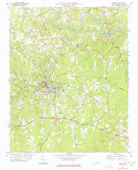
1977 Map of Robbins
USGS Topo · Published 1977About this map
Robbins serves as the industrial and civic heart of this Moore County landscape, situated where the Norfolk Southern railroad crosses the winding waters of Bear Creek. The map documents the town's mid-century infrastructure, including the Filtration Plant, Sewage Disposal, and several named schools like Elise Sch and North Moore Sch. Along the northern reaches, the Deep River carves a dramatic path through the terrain, supporting the community of High Falls and its associated High Falls Church.
Find a feature on this map
72 named features on this map. Tap any name to fly to it.
Don’t see what you’re looking for? This feature index may not catch every label — zoom into the map to look around manually.
Map Details
Editions of this 1977 Robbins Map
This is the sole edition of this map. No revisions or reprints were ever made.
Other maps of this area

1942 · Troy
USGS Topo · 1:125,000

1953 · Raleigh
USGS Topo · 1:250,000

1954 · Raleigh
USGS Topo · 1:250,000

1968 · Erect
USGS Topo · 1:24,000

1968 · Bennett
USGS Topo · 1:24,000

1970 · Bear Creek
USGS Topo · 1:24,000
1974 · Carthage
USGS Topo · 1:24,000

1974 · Putnam
USGS Topo · 1:24,000

1974 · Candor
USGS Topo · 1:24,000
1977 · Spies
USGS Topo · 1:24,000