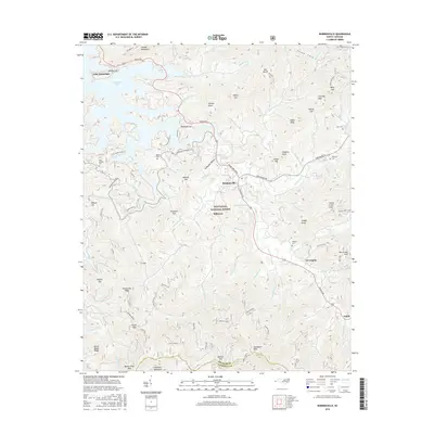
2016 Map of Robbinsville
USGS Topo · Published 2016About this map
Robbinsville serves as the central hub of this mountain landscape, situated at the junction of the Rodney Orr Bypass and Sweetwater Rd. Within the Nantahala National Forest, the terrain is defined by the high ridges of the Cheoah Mountains and Snowbird Mountains, reaching a high point at Teyahalee Bald. The map documents the area's industrial and family history through features like the Massey Quarry, a Gold Pit, and the Payne Sawmill, alongside several legacy burial grounds such as West Buffalo Cem and Rice Cem. To the northwest, the fingers of Lake Santeetlah reach into the valleys, while the Cherohala Skyway traverses the gaps. This 2016 survey illustrates a modern mountain community where timber and recreation roots intersect with old family landholdings like Holloway Cem and Massey Cem.
Find a feature on this map
112 named features on this map. Tap any name to fly to it.
Don’t see what you’re looking for? This feature index may not catch every label — zoom into the map to look around manually.
Map Details
Editions of this 2016 Robbinsville Map
This is the sole edition of this map. No revisions or reprints were ever made.
Other maps of this area

1933 · Bushnell
USGS Topo · 1:62,500

1935 · Robbinsville
USGS Topo · 1:24,000

1935 · Fontana
USGS Topo · 1:24,000

1935 · Topton
USGS Topo · 1:24,000

1935 · Marble
USGS Topo · 1:24,000

1935 · Wayah Bald
USGS Topo · 1:48,000

1935 · Santeetlah Creek
USGS Topo · 1:24,000

1935 · Andrews
USGS Topo · 1:24,000
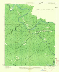
1935 · Tapoco
USGS Topo · 1:24,000

1936 · Proctor
USGS Topo · 1:24,000