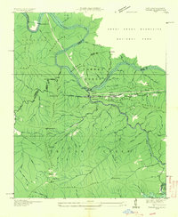
1935 Map of Tapoco
USGS Topo · Published 1935About this map
Little Tennessee River hydroelectric development defines this mid-1930s landscape where industrial engineering meets the high ridges of the Southern Appalachians. The Aluminum Company of America presence is pervasive, marked by its massive infrastructure projects including Cheoah Dam, Calderwood Dam, and a prominent transmission line cutting across the terrain. These industrial features contrast with the rural life centered around the settlement of Tapoco and local spiritual hubs like Bethel Ch and Primitive Ch.
Find a feature on this map
81 named features on this map. Tap any name to fly to it.
Don’t see what you’re looking for? This feature index may not catch every label — zoom into the map to look around manually.
Map Details
Editions of this 1935 Tapoco Map
This is the sole edition of this map. No revisions or reprints were ever made.
Other maps of this area

1886 · Knoxville
USGS Topo · 1:125,000

1892 · Knoxville
USGS Topo · 1:125,000

1893 · Murphy
USGS Topo · 1:125,000

1894 · Knoxville
USGS Topo · 1:125,000

1895 · Loudon
USGS Topo · 1:125,000

1895 · Knoxville
USGS Topo · 1:125,000

1901 · Knoxville
USGS Topo · 1:125,000

1914 · Murphy
USGS Topo · 1:125,000

1927 · Big Junction
USGS Topo · 1:24,000

1933 · Haw Knob
USGS Topo · 1:48,000