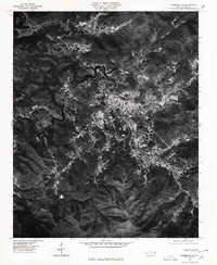
1976 Map of Robbinsville
USGS Topo · Published 1978About this map
Robbinsville serves as the focal point of this 1970s orthophotoquad, situated in a valley between the high ridges of the Cheoah Mountains and the Snowbird Mountains. Unlike traditional topographic maps, this aerial imagery provides a direct look at the mid-decade land use patterns, showing the clearings for agriculture and the dense forest cover typical of Graham County. To the west, the winding reaches of Santeetlah Lake cut through the terrain, while smaller communities like Milltown, Sweetgum, and Tulula follow the lowlands and road corridors. The orthophoto reveals the exact footprint of buildings and roads as they existed during this period of the 1970s, offering researchers a literal view of the landscape that contour lines alone cannot convey.
Find a feature on this map
7 named features on this map. Tap any name to fly to it.
Don’t see what you’re looking for? This feature index may not catch every label — zoom into the map to look around manually.
Map Details
Editions of this 1976 Robbinsville Map
This is the sole edition of this map. No revisions or reprints were ever made.
Other maps of this area

1933 · Bushnell
USGS Topo · 1:62,500

1935 · Robbinsville
USGS Topo · 1:24,000

1935 · Fontana
USGS Topo · 1:24,000

1935 · Topton
USGS Topo · 1:24,000

1935 · Marble
USGS Topo · 1:24,000

1935 · Wayah Bald
USGS Topo · 1:48,000

1935 · Santeetlah Creek
USGS Topo · 1:24,000

1935 · Andrews
USGS Topo · 1:24,000
1935 · Tapoco
USGS Topo · 1:24,000

1936 · Proctor
USGS Topo · 1:24,000