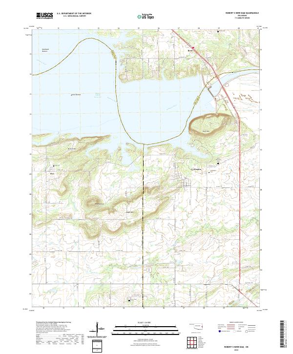
2022 Map of Robert S Kerr Dam
USGS Topo · Published 2022About this map
The Arkansas River corridor and the expansive Robert S Kerr Reservoir dominate this landscape, where the borders of Sequoyah, Haskell, and Le Flore counties converge. The terrain is defined by distinct elevations like Short Mtn and Gingle Mtn, rising above the fertile floodplains of Mulehead Bottom and Blaine Bottom. This area preserves several small communities, most notably Cowlington and Brent, which serve as anchors for local genealogy research.
Find a feature on this map
72 named features on this map. Tap any name to fly to it.
Don’t see what you’re looking for? This feature index may not catch every label — zoom into the map to look around manually.
Map Details
Editions of this 2022 Robert S Kerr Dam Map
This is the sole edition of this map. No revisions or reprints were ever made.
Other maps of this area

1900 · Sallisaw
USGS Topo · 1:125,000

1911 · Sallisaw
USGS Topo · 1:125,000

1946 · Fort Smith
USGS Topo · 1:250,000

1965 · Fort Smith
USGS Topo · 1:250,000

1966 · Gans
USGS Topo · 1:24,000

1966 · Muldrow SW
USGS Topo · 1:24,000

1967 · Fort Smith
USGS Topo · 1:250,000
1967 · Keota
USGS Topo · 1:24,000
1967 · Sallisaw
USGS Topo · 1:24,000

1967 · Robert S Kerr Dam
USGS Topo · 1:24,000