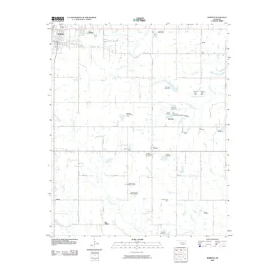
2010 Map of Roberta
USGS Topo · Published 2010About this map
Pioneer Cemetery and the southeastern edge of Durant anchor this landscape in Bryan County, Oklahoma. The map reveals a transition from the urban developments of Lee Heights into a rural network defined by family-named landholdings and extensive water management. A high density of private and small-scale reservoirs, such as Mattingly Lake Number 1 Dam and Shepard Lake Dam, indicates the critical role of water storage for local agriculture and livestock in the early 21st century.
Find a feature on this map
48 named features on this map. Tap any name to fly to it.
Don’t see what you’re looking for? This feature index may not catch every label — zoom into the map to look around manually.
Map Details
Editions of this 2010 Roberta Map
This is the sole edition of this map. No revisions or reprints were ever made.
Other maps of this area

1899 · Atoka
USGS Topo · 1:125,000

1900 · Atoka
USGS Topo · 1:125,000

1954 · Sherman
USGS Topo · 1:250,000

1957 · Wade
USGS Topo · 1:62,500

1957 · Ardmore
USGS Topo · 1:250,000

1958 · Durant
USGS Topo · 1:62,500

1958 · Sherman
USGS Topo · 1:250,000

1963 · Ardmore
USGS Topo · 1:250,000
1968 · Durant North
USGS Topo · 1:24,000

1969 · Bokchito
USGS Topo · 1:24,000