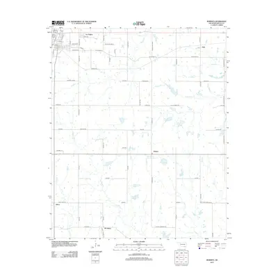
2012 Map of Roberta
USGS Topo · Published 2012About this map
Lee Heights and the northern outskirts of Durant define the upper reaches of this Bryan County landscape in the early twenty-first century. The transition from the residential development around Pioneer Cem to the sprawling agricultural tracts of southern Oklahoma is evident along the corridor of Old Highway 70. This area is characterized by a dense network of farm-to-market roads and small, family-named water bodies, such as Isom 1 Lake and Shepard Lake, which dot the terrain between Roberta and Pirtle.
Find a feature on this map
79 named features on this map. Tap any name to fly to it.
Don’t see what you’re looking for? This feature index may not catch every label — zoom into the map to look around manually.
Map Details
Editions of this 2012 Roberta Map
This is the sole edition of this map. No revisions or reprints were ever made.
Other maps of this area

1899 · Atoka
USGS Topo · 1:125,000

1900 · Atoka
USGS Topo · 1:125,000

1954 · Sherman
USGS Topo · 1:250,000

1957 · Wade
USGS Topo · 1:62,500

1957 · Ardmore
USGS Topo · 1:250,000

1958 · Durant
USGS Topo · 1:62,500

1958 · Sherman
USGS Topo · 1:250,000

1963 · Ardmore
USGS Topo · 1:250,000
1968 · Durant North
USGS Topo · 1:24,000

1969 · Bokchito
USGS Topo · 1:24,000