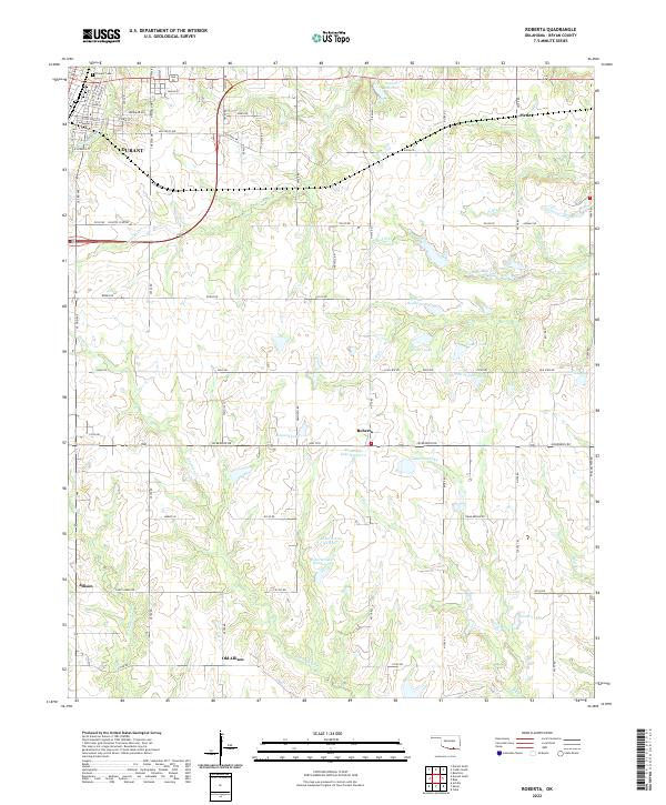
2022 Map of Roberta
USGS Topo · Published 2022About this map
Durant anchors the northwest corner of this Bryan County landscape, where the urban grid gives way to a network of creeks and small reservoirs. The transition from the town's residential streets, such as E Main St and Hillcrest Ave, into the agricultural hinterland reveals a complex drainage system fed by Sassafras Cr, Long Cr, and Mineral Bayou. Small settlements like Pirtle and Roberta are interspersed among numerous private water bodies, including Isom 1 Lake, Anderson Lake, and Shepard Lake, illustrating the regional reliance on managed water resources for ranching and recreation.
Find a feature on this map
75 named features on this map. Tap any name to fly to it.
Don’t see what you’re looking for? This feature index may not catch every label — zoom into the map to look around manually.
Map Details
Editions of this 2022 Roberta Map
This is the sole edition of this map. No revisions or reprints were ever made.
Other maps of this area

1899 · Atoka
USGS Topo · 1:125,000

1900 · Atoka
USGS Topo · 1:125,000

1954 · Sherman
USGS Topo · 1:250,000

1957 · Wade
USGS Topo · 1:62,500

1957 · Ardmore
USGS Topo · 1:250,000

1958 · Durant
USGS Topo · 1:62,500

1958 · Sherman
USGS Topo · 1:250,000

1963 · Ardmore
USGS Topo · 1:250,000
1968 · Durant North
USGS Topo · 1:24,000

1969 · Bokchito
USGS Topo · 1:24,000