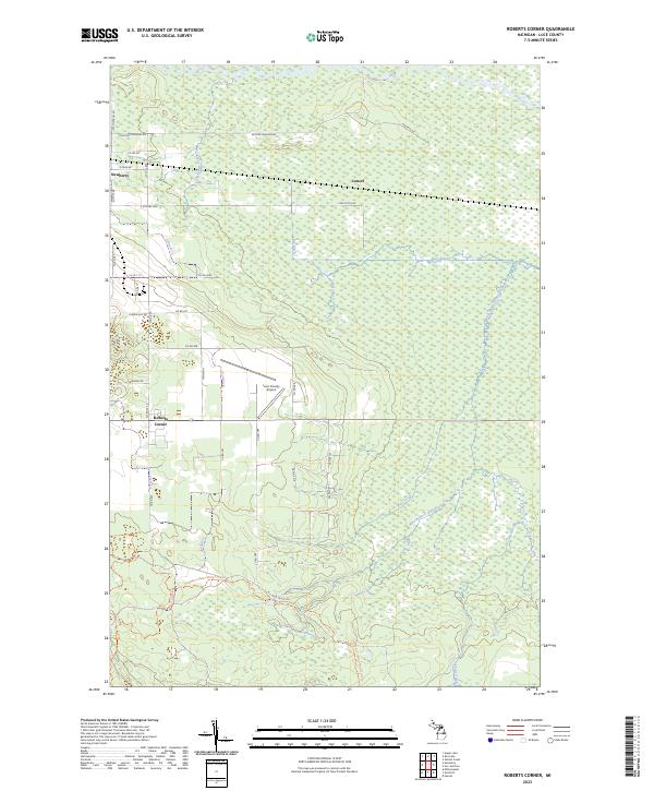
2023 Map of Roberts Corner
USGS Topo · Published 2023About this map
Newberry and the rural junction of Roberts Corner anchor this landscape in Luce County, characterized by a complex network of wetlands and managed timberlands. The Tahquamenon River flows across the northern reaches, while the Sage River and its West Branch Sage River drain the eastern lowlands. This modern survey reflects the area's contemporary infrastructure, including the Luce County Airport and a grid of county roads such as Co Rd 403 and Co Rd 399. Recreational and industrial use is evident in the extensive trail systems, notably the Newberry-rexton Motorcycle Trl and various truck trails like the Mc Leod Truck Trl. The presence of the Big Ditch and numerous unnamed wetland tracts suggests a history of water management in this Upper Peninsula terrain, where small settlements like Lencel dot the landscape.
Find a feature on this map
37 named features on this map. Tap any name to fly to it.
Don’t see what you’re looking for? This feature index may not catch every label — zoom into the map to look around manually.
Map Details
Editions of this 2023 Roberts Corner Map
This is the sole edition of this map. No revisions or reprints were ever made.
Other maps of this area

1931 · Gould City NE
USGS Topo · 1:31,680

1931 · Gilchrist NE
USGS Topo · 1:31,680

1931 · Gilchrist NW
USGS Topo · 1:31,680

1954 · Sault Sainte Marie
USGS Topo · 1:250,000

1956 · Sault Sainte Marie
USGS Topo · 1:250,000

1957 · Sault Sainte Marie
USGS Topo · 1:250,000

1958 · Sault Sainte Marie
USGS Topo · 1:250,000

1962 · Auger Lake
USGS Topo · 1:24,000
1973 · Newberry
USGS Topo · 1:24,000
1973 · Gilchrist
USGS Topo · 1:24,000