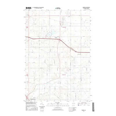
2015 Map of Roberts
USGS Topo · Published 2015About this map
Roberts serves as a central hub on this landscape, situated just north of the meandering Kinnickinnic River. The terrain is defined by a dense network of local roads and several significant waterways, including Trout Brook and Nye Cr, which drain the surrounding agricultural and rural lands. Evidence of early settlement patterns remains visible through established landmarks such as Warren Cem in the north and Kinnickinnic Cem further south. The southern edge of the map reaches the outskirts of River Falls, showing the relationship between these small communities and the river system. Features like Twin Lakes provide a distinct contrast to the grid-like road structure, which includes local thoroughfares like Co Hwy TT and Co Rd N. This topographic survey provides a clear view of the suburban and rural development in St. Croix County during the mid-2010s.
Find a feature on this map
40 named features on this map. Tap any name to fly to it.
Don’t see what you’re looking for? This feature index may not catch every label — zoom into the map to look around manually.
Map Details
Editions of this 2015 Roberts Map
This is the sole edition of this map. No revisions or reprints were ever made.
Other maps of this area

1946 · River Falls
USGS Topo · 1:62,500

1948 · New Richmond
USGS Topo · 1:62,500

1949 · New Richmond
USGS Topo · 1:62,500

1949 · River Falls
USGS Topo · 1:62,500

1949 · Baldwin
USGS Topo · 1:62,500

1950 · Deer Park
USGS Topo · 1:62,500

1953 · Saint Paul
USGS Topo · 1:250,000

1953 · Stillwater
USGS Topo · 1:250,000

1955 · Stillwater
USGS Topo · 1:250,000

1958 · Stillwater
USGS Topo · 1:250,000