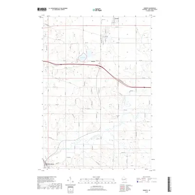
2018 Map of Roberts
USGS Topo · Published 2018About this map
Roberts serves as the central hub of this Saint Croix County landscape, where the grain-belt terrain of western Wisconsin meets the expanding suburban reaches of River Falls. The geography is defined by the winding course of the Kinnickinnic River and its numerous tributaries, including Nye Cr and Kelly Cr, which carve through the glacial topography. Notable for local historians and genealogists, the map identifies the Warren Cem near the northern boundary and the Kinnickinnic Cem further south. The presence of the Sccwpa indicates dedicated conservation or public areas, while Twin Lakes provides a significant water feature just west of the Roberts town center. The road network, including the diagonal path of the interstate and local routes like Coulee Trl and Town Hall Rd, illustrates the modern transition of this agricultural region into a residential and commuter corridor.
Find a feature on this map
74 named features on this map. Tap any name to fly to it.
Don’t see what you’re looking for? This feature index may not catch every label — zoom into the map to look around manually.
Map Details
Editions of this 2018 Roberts Map
This is the sole edition of this map. No revisions or reprints were ever made.
Other maps of this area

1946 · River Falls
USGS Topo · 1:62,500

1948 · New Richmond
USGS Topo · 1:62,500

1949 · New Richmond
USGS Topo · 1:62,500

1949 · River Falls
USGS Topo · 1:62,500

1949 · Baldwin
USGS Topo · 1:62,500

1950 · Deer Park
USGS Topo · 1:62,500

1953 · Saint Paul
USGS Topo · 1:250,000

1953 · Stillwater
USGS Topo · 1:250,000

1955 · Stillwater
USGS Topo · 1:250,000

1958 · Stillwater
USGS Topo · 1:250,000