
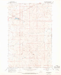
1965 Map of Robertson School
USGS Topo · Published 1968About this map
Robertson Sch stands as a primary landmark in this rural Garfield County landscape, signifying the central role of localized education in Montana's ranching districts during the mid-1960s. The terrain is characterized by dissected drainage patterns feeding into Big Dry Creek and Dry Creek, with the seasonal Alkali Draw cutting through the southeastern corner.
Find a feature on this map
9 named features on this map. Tap any name to fly to it.
Don’t see what you’re looking for? This feature index may not catch every label — zoom into the map to look around manually.
Map Details
Editions of this 1965 Robertson School Map
This is the sole edition of this map. No revisions or reprints were ever made.
Other maps of this area

1954 · Jordan
USGS Topo · 1:250,000

1954 · Forsyth
USGS Topo · 1:250,000

1956 · Jordan
USGS Topo · 1:250,000

1957 · Forsyth
USGS Topo · 1:250,000

1958 · Jordan
USGS Topo · 1:250,000

1958 · Forsyth
USGS Topo · 1:250,000

1964 · Jordan
USGS Topo · 1:250,000

1965 · Big Dry School
USGS Topo · 1:24,000

1965 · Edwards
USGS Topo · 1:24,000
1965 · Sand Springs
USGS Topo · 1:24,000