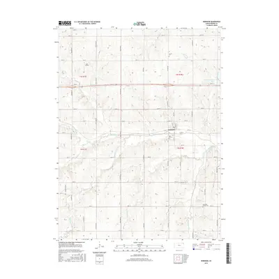
2015 Map of Robinson
USGS Topo · Published 2015About this map
Robinson serves as the central hub of this agricultural landscape in Brown County, where a network of section-line roads like Prairie Rd and Nighthawk Rd divides the terrain into traditional farming blocks. The area is defined by the branching hydrography of the Wolf River, including its N Fork, Middle Fork, and S Fork tributaries. These waterways create natural corridors across the township boundaries of t2s r18e and t3s r18e.
Find a feature on this map
46 named features on this map. Tap any name to fly to it.
Don’t see what you’re looking for? This feature index may not catch every label — zoom into the map to look around manually.
Map Details
Editions of this 2015 Robinson Map
This is the sole edition of this map. No revisions or reprints were ever made.
Other maps of this area

1885 · Atchison
USGS Topo · 1:125,000

1888 · Atchison
USGS Topo · 1:125,000

1888 · Hiawatha
USGS Topo · 1:125,000

1893 · Atchison
USGS Topo · 1:125,000

1894 · Hiawatha
USGS Topo · 1:125,000

1950 · Kansas City
USGS Topo · 1:250,000

1954 · Kansas City
USGS Topo · 1:250,000

1956 · Kansas City
USGS Topo · 1:250,000
1959 · White Cloud
USGS Topo · 1:24,000
1959 · Highland
USGS Topo · 1:24,000