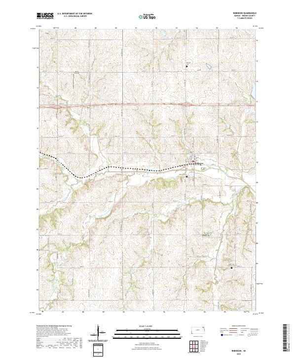
2022 Map of Robinson
USGS Topo · Published 2022About this map
The settlement of Robinson anchors this landscape in eastern Brown County, situated at the intersection of Main St and 210th St. This agricultural region is defined by a dendritic network of waterways, most notably the Wolf River and its various tributaries including the Middle Fork and South Fork. These streams create a complex pattern of drainage that dictates the local topography, with Buttermilk Cr and Roys Cr carving further into the prairie. Genealogists will find significant value in several local burial sites, such as the Ununda Cem to the north and the Upper Wolf Lutheran Cem in the southeast. Near the northern boundary, the Davis Airfield stands as a distinct landmark along Old 36, while a strict grid of section-line roads like Sagebrush Rd and Nighthawk Rd organizes the surrounding farmland.
Find a feature on this map
44 named features on this map. Tap any name to fly to it.
Don’t see what you’re looking for? This feature index may not catch every label — zoom into the map to look around manually.
Map Details
Editions of this 2022 Robinson Map
This is the sole edition of this map. No revisions or reprints were ever made.
Other maps of this area

1885 · Atchison
USGS Topo · 1:125,000

1888 · Atchison
USGS Topo · 1:125,000

1888 · Hiawatha
USGS Topo · 1:125,000

1893 · Atchison
USGS Topo · 1:125,000

1894 · Hiawatha
USGS Topo · 1:125,000

1950 · Kansas City
USGS Topo · 1:250,000

1954 · Kansas City
USGS Topo · 1:250,000

1956 · Kansas City
USGS Topo · 1:250,000
1959 · White Cloud
USGS Topo · 1:24,000
1959 · Highland
USGS Topo · 1:24,000