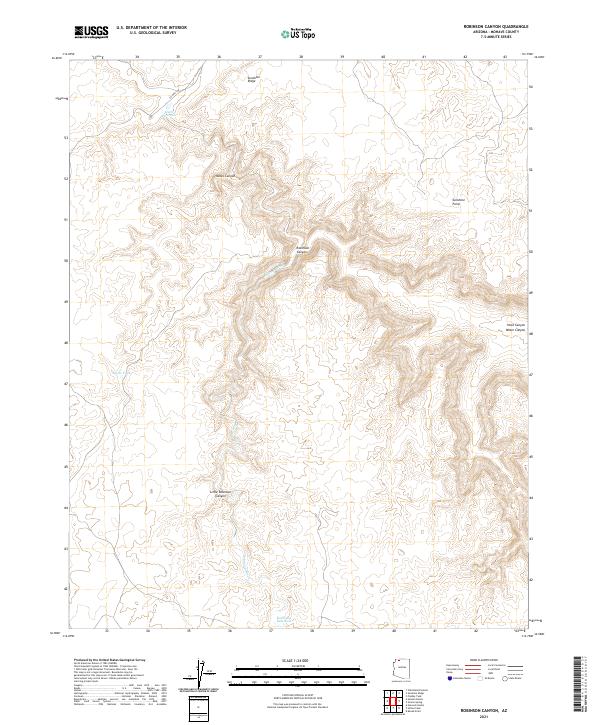
2021 Map of Robinson Canyon
USGS Topo · Published 2021About this map
Robinson Canyon and its many offshoots, including Little Robinson Canyon and Nates Canyon, carve a complex drainage system across this Mohave County landscape. The area is defined by sharp topographic relief between Sunshine Ridge in the north and Sunshine Point to the east. Water management is a primary feature of this arid environment, evidenced by scattered catchments such as Hack Reservoir, Robinson Reservoir, and Nates Tank. These man-made features support land use in a region where Robinson Wash serves as the principal natural drainage. While largely unpopulated, the presence of CO Hwy 109 provides the only significant transportation artery through the western portion of the quadrangle, illustrating the isolation of these canyonlands.
Find a feature on this map
16 named features on this map. Tap any name to fly to it.
Don’t see what you’re looking for? This feature index may not catch every label — zoom into the map to look around manually.
Map Details
Editions of this 2021 Robinson Canyon Map
This is the sole edition of this map. No revisions or reprints were ever made.
Other maps of this area

1886 · Kaibab
USGS Topo · 1:250,000

1953 · Grand Canyon
USGS Topo · 1:250,000

1954 · Heaton Knolls NW
USGS Topo · 1:24,000

1954 · Heaton Knolls SE
USGS Topo · 1:24,000

1954 · Heaton Knolls
USGS Topo · 1:62,500

1957 · Grand Canyon
USGS Topo · 1:250,000

1957 · Jumpup Canyon
USGS Topo · 1:62,500

1958 · Grand Canyon
USGS Topo · 1:250,000

1960 · Grand Canyon
USGS Topo · 1:250,000

1962 · Kanab Point
USGS Topo · 1:62,500