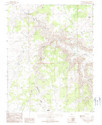
1988 Map of Robinson Canyon
USGS Topo · Published 1988About this map
Hack Canyon Mine and its surrounding network of adits and shafts define this remote mining landscape in Mohave County. In this late 1980s environment, water management is the primary marker of human intervention, seen through a scattered system of livestock or industrial infrastructure like Hack Reservoir, Robinson Reservoir, and Hitson Tank. The terrain is dominated by high plateaus and deep drainage cuts, most notably Sunshine Point and the dramatic drop into Hack Canyon. Transportation is limited to narrow 4wd tracks that follow the natural contours of the land, navigating between Sunshine Ridge and the broad Robinson Canyon Wash. This survey documents a working desert landscape where mineral extraction and ranching requirements dictated the placement of every named feature, from the smallest Prospect to the largest catch basin.
Find a feature on this map
17 named features on this map. Tap any name to fly to it.
Don’t see what you’re looking for? This feature index may not catch every label — zoom into the map to look around manually.
Map Details
Editions of this 1988 Robinson Canyon Map
This is the sole edition of this map. No revisions or reprints were ever made.
Other maps of this area

1886 · Kaibab
USGS Topo · 1:250,000

1953 · Grand Canyon
USGS Topo · 1:250,000

1954 · Heaton Knolls NW
USGS Topo · 1:24,000

1954 · Heaton Knolls SE
USGS Topo · 1:24,000

1954 · Heaton Knolls
USGS Topo · 1:62,500

1957 · Grand Canyon
USGS Topo · 1:250,000

1957 · Jumpup Canyon
USGS Topo · 1:62,500

1958 · Grand Canyon
USGS Topo · 1:250,000

1960 · Grand Canyon
USGS Topo · 1:250,000

1962 · Kanab Point
USGS Topo · 1:62,500