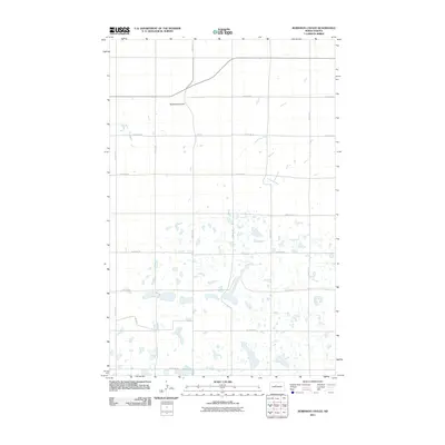
2011 Map of Robinson Coulee
USGS Topo · Published 2011About this map
Robinson Coulee carves through this northern prairie landscape, which is defined by a dense concentration of small water bodies and wetlands. In the southern portion of this region, dozens of small prairie potholes create a complex hydrological network, likely serving as critical habitat within the Missouri Coteau landform. This 2011 survey by the U. S. Geological Survey captures a region structured by an orderly grid of section lines and rural routes, such as 275th Ave SE and 139th St SE, which facilitate access across the open terrain. The primary thoroughfare, State Route 23, cuts through the northern section of the map, providing a major corridor across the coulee. The lack of concentrated settlements highlights the deeply rural and agricultural nature of this part of Ward County, where land use is oriented around the unique drainage patterns of the northern plains.
Find a feature on this map
17 named features on this map. Tap any name to fly to it.
Don’t see what you’re looking for? This feature index may not catch every label — zoom into the map to look around manually.
Map Details
Editions of this 2011 Robinson Coulee Map
This is the sole edition of this map. No revisions or reprints were ever made.
Other maps of this area

1929 · Sawyer
USGS Topo · 1:62,500

1929 · Benedict
USGS Topo · 1:62,500

1929 · Kongsberg
USGS Topo · 1:62,500

1948 · Velva
USGS Topo · 1:62,500

1948 · Sawyer
USGS Topo · 1:24,000

1949 · Sawyer
USGS Topo · 1:24,000

1949 · Velva
USGS Topo · 1:24,000

1949 · Sawyer
USGS Topo · 1:62,500
1950 · Sawyer SW
USGS Topo · 1:24,000

1951 · Velva
USGS Topo · 1:62,500