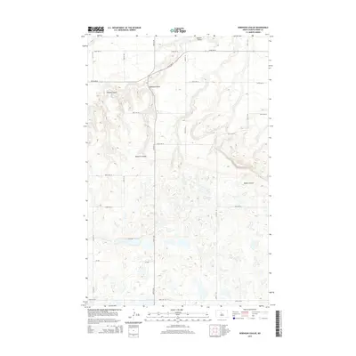
2014 Map of Robinson Coulee
USGS Topo · Published 2014About this map
Robinson Coulee carves through the undulating prairie of Ward County in this 2014 survey, highlighting the distinctive glacial topography of the North Dakota landscape. The drainage system, characterized by the namesake coulee and its neighbors Bonnes Coulee and Bowers Coulee, reveals a terrain defined by complex elevation changes and numerous small depressions typical of the region's hydrography. The map documents a meticulously gridded agricultural landscape, where section-line roads such as 139th St SE and 247th Ave SE impose a geometric order on the natural drainage patterns. This intersection of a rigid survey grid with the meandering natural coulees provides a clear view of how rural infrastructure adapt to the northern plains' specific water-carved features.
Find a feature on this map
18 named features on this map. Tap any name to fly to it.
Don’t see what you’re looking for? This feature index may not catch every label — zoom into the map to look around manually.
Map Details
Editions of this 2014 Robinson Coulee Map
This is the sole edition of this map. No revisions or reprints were ever made.
Other maps of this area

1929 · Sawyer
USGS Topo · 1:62,500

1929 · Benedict
USGS Topo · 1:62,500

1929 · Kongsberg
USGS Topo · 1:62,500

1948 · Velva
USGS Topo · 1:62,500

1948 · Sawyer
USGS Topo · 1:24,000

1949 · Sawyer
USGS Topo · 1:24,000

1949 · Velva
USGS Topo · 1:24,000

1949 · Sawyer
USGS Topo · 1:62,500
1950 · Sawyer SW
USGS Topo · 1:24,000

1951 · Velva
USGS Topo · 1:62,500